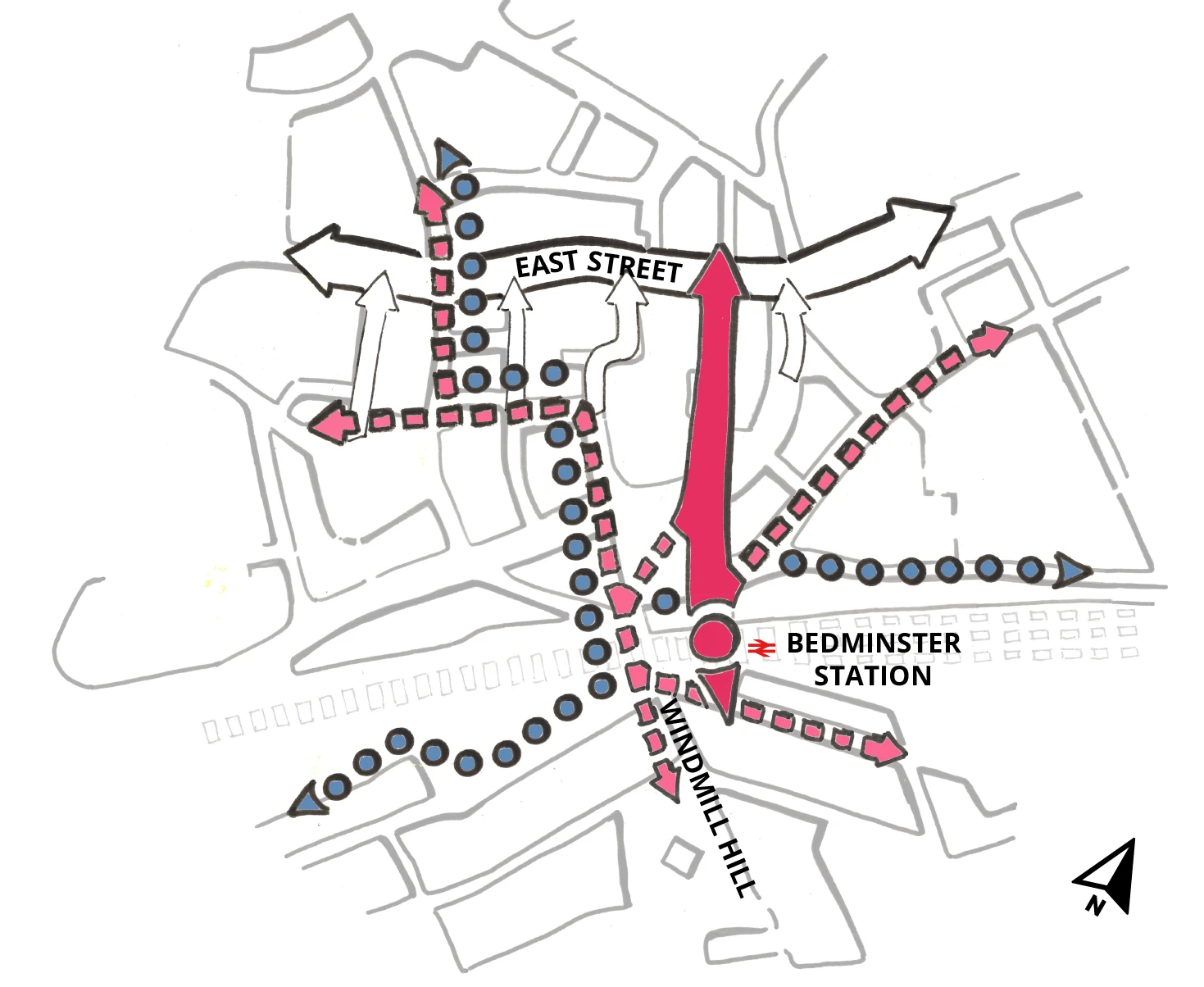
Connecting the neighbourhood
A strong and active route between Windmill Hill, Bedminster station and East Street will underpin the neighbourhood. This principal connection will be complemented by a variety of pedestrian and cycle routes that form an integral part of the new neighbourhood to integrate it with neighbouring parts of the city. Introducing more people to the area, served by good public transport and active travel provision, will support local facilities and amenities.
Key objectives
Focus on the streets
Streets will be enclosed and spaces framed by buildings to create a safe and legible environment. Frontages should be appropriate to the street hierarchy and help to activate key spaces.
Walking and cycling
When organising routes and streets consideration and balance will be given to active travel first.
Views to Bedminster station
Creating a prominent frontage and an accessible new entrance to the station, with a direct link and line of sight to East Street, will improve legibility and promote the use of public transport.
Safe crossings
Crossing Dalby Avenue should be done with ease and convenience. Pedestrian desire lines within the neighbourhood will be prioritised.

Main pedestrian movement
Strategic cycle movement
Diagram taken from Bedminster Green Place-Making Framework (2019)
Framework quick links
Illustration: Diagrammatic only; not to scale or in proportion. All precedents and ideas are only one possible approach and do not preclude alternative approaches that address the same challenges.
You can read the full Bedminster Green Framework.